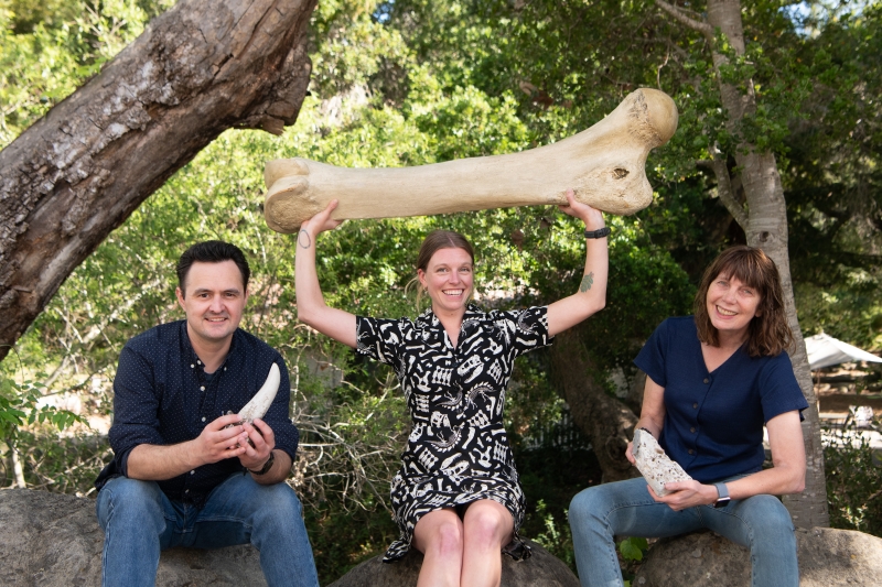
Handy Rock & Fossil Facts
What about this fossil?
Most of the “fossils” people ask us to identify aren’t fossils.
As humans, we are all quick to recognize patterns. Most of the time, this ability is helpful and assists us in surviving and thriving, but sometimes our pattern-recognizing brains draw bogus conclusions based on what we want to see or expect to see. This can be a fun pastime when it takes the form of telling each other what clouds look like to us, or agreeing with everyone on the planet that a unique agate looks exactly like the Cookie Monster.
Folks often show us what looks to them like some sort of fossil, but is actually a rock with a geologic history that created shapes reminiscent of life’s traces. Those shapes trigger our natural human powers of pattern recognition. For instance, we all know what an egg looks like. Fossil eggs are extremely rare, but egg-shaped rocks with cracks in them are everywhere, triggering our pattern recognition and our hope of finding something especially awesome.
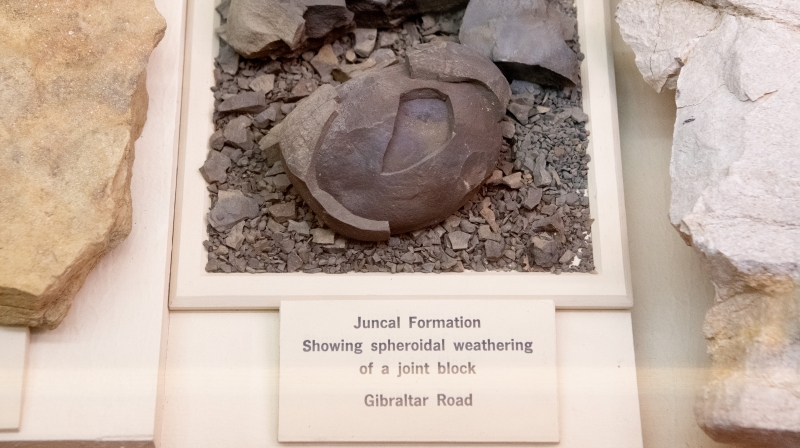
This rock in our Earth Science exhibits almost looks like an egg with multiple shells, but—like the face of Keith Richards—its interesting appearance is actually the result of weathering.
Experts have a big edge when it comes to distinguishing and identifying fossils, in part because we have had time and opportunities to hone our pattern recognition skills. Taking time to study real fossils, you notice textures—like porous bone, or the ridges of a scallop—that help you distinguish the real thing. Textures and details matter, and so does context; some rocks were formed under conditions that preserved fossils and others were not. Experts who constantly work with collections of specimens quickly recognize familiar patterns of life or geology. You can improve your own skills by studying nature. Museum exhibits are a great place to start.
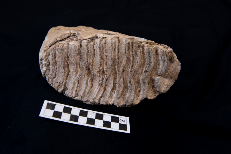
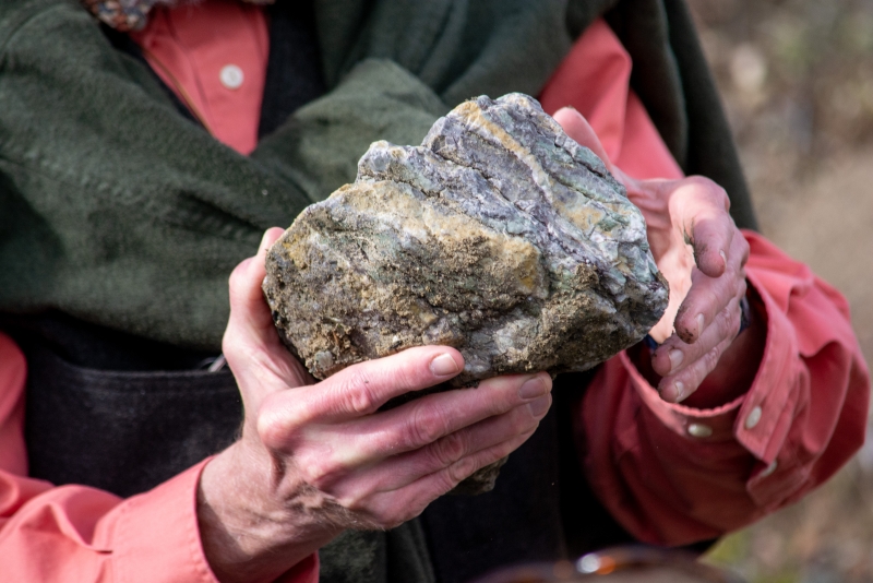
Did you recognize this as a mammoth tooth from the Channel Islands? Experts have an edge when it comes to identifying fossils like this one, in part because they work with collections that include both fossils and the remains of present-day organisms. Modern elephants have molars very similar to this one.
Our region was underwater for a lot of Earth’s history…including the Age of Reptiles! This is one reason we don’t expect to find dinosaur fossils here. Generally, the few dinosaurs found in California are the result of “bloat and float”: animals whose dead bodies drifted downstream and out to sea. Another reason for our lack of dinosaur fossils is that the local rock formations from that time period have since been subjected to metamorphic forces capable of deforming and breaking apart what might have originally been preserved.
A fossil probably wouldn’t survive the extreme conditions this rock found in the Santa Ynez Valley has endured.
Invertebrate fossils are abundant here on the Central Coast. During some of that time underwater, marine organisms created shells which sedimentary formations beautifully preserved. To increase your chances of spotting and appreciating local fossils, get to know these local rock formations:
The Coldwater Formation was deposited during the middle to late Eocene epoch, from about 48 to 34 million years ago. It’s made of sandstone and shale. Coldwater Formation boulders containing fossilized bivalves (mollusks with a two-part shell, like clams, scallops, oysters) are often seen on frontcountry canyon trails in Santa Barbara.
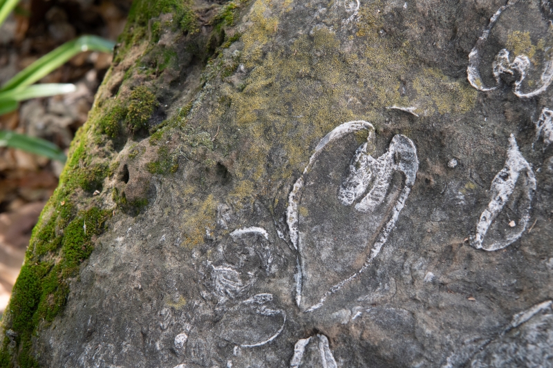
A boulder from the Coldwater Formation with embedded clamshells from the family Veneridae, the Venus clams. Can you find this boulder at the Museum? It’s under the spreading boughs of a very large tree.
The Monterey Formation is from the Miocene Epoch, about 23 to 5 million years ago. Look for it in bluffs facing the sea all over our coast, particularly at Arroyo Burro and in Goleta. The Monterey Formation has yielded many fossils including marine mammals like whales and dolphins, invertebrates like mollusks and crustaceans, microorganisms, and algaes.
The Santa Barbara Formation is made of fairly loose marine sand from the Pleistocene Epoch (about 2.5 million to 11,700 years ago). It contains abundant marine invertebrates like bivalves, gastropods (snails), and barnacles. Outcroppings can be found in the lowlands, notably in the cliffs around the Mesa and Santa Barbara City College.
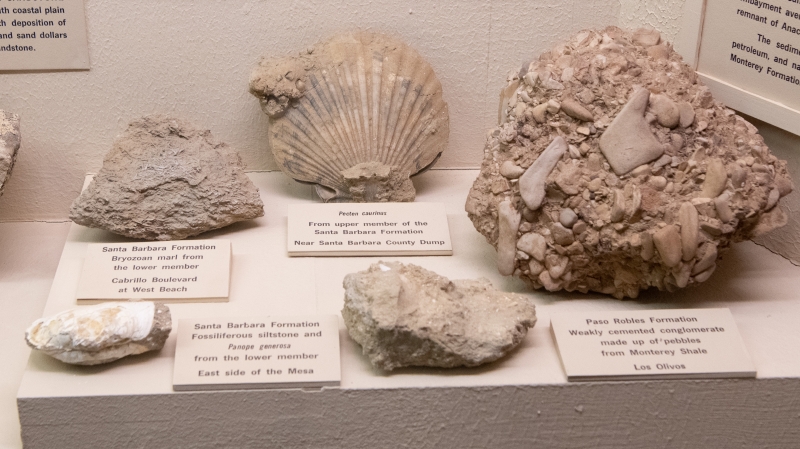
Santa Barbara Formation fossils on display at the Museum
We have many specimens in our Earth Science Collections from the Higgins Pit in Carpinteria, a local asphaltum deposit (also known as a tar pit) that trapped traces of life from tens of thousands of years ago in the late Pleistocene. In addition to well-preserved pinecones—evidence of how the local landscape was different when the pit was capturing life—we have the bones of numerous mesocarnivores (medium-sized carnivores) and numerous birds. Asphaltum deposits are really cool for preserving bird bones in particular. The hollow bones of birds are delicate and often get crushed in other geologic contexts, but asphaltum preserves them nicely. We currently have some fossils from tar pits (including the Higgins Pit) on display in our Earth Science exhibits, including the limb of an early horse and some bones from Pleistocene turkeys and vultures. In addition to those real fossils, we have some replicas from the La Brea Tar Pits on display.
If you’re interested in learning more about local rock formations, come check out our Earth Science exhibits. They are pretty old-school (most of them predate the theory of plate tectonics!) but do contain excellent examples of local rocks and maps showing the age of the different formations and where they are found.
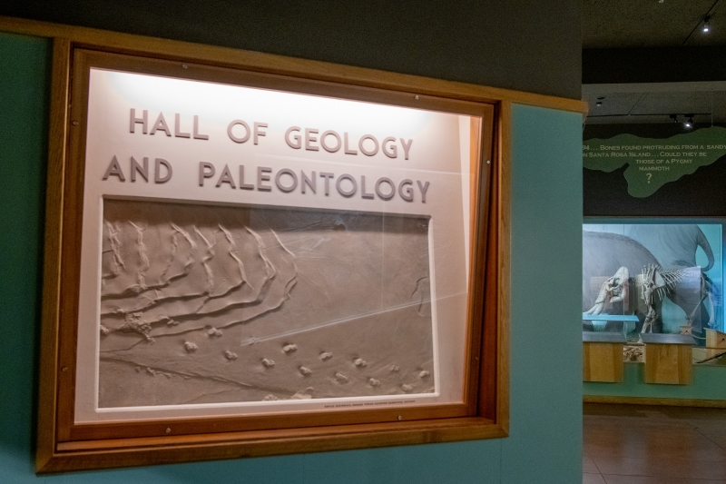
Our Earth Science exhibits are located between Marine Science and Chumash Life.
For more detailed insight on what formations are exposed where, check out the geologic maps created by legendary California geologist and cartographer Thomas W. Dibblee, Jr., available in the Museum Store both online and in person. To find the right map for your location, check this index map to Dibblee’s geologic maps.
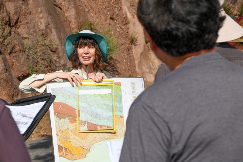
Taking a Dibblee map up Gibraltar Road during one of the Museum’s geology classes led by geologist and Nature Education Manager Sabina Thomas, Ph.D.
Rocks are underrated
Even ordinary rocks can tell interesting stories. They’re old and have seen a lot. If you know what to watch for, you can find out where and how rocks have formed, deep in the Earth’s crust, or even deeper—in the mantle. You can discover if they’ve been pushed around by water, wind, or ice. We live on rocks; they give us resources: metals, building stones, tools, and soil. Saying “It’s just a rock” doesn’t do them justice.
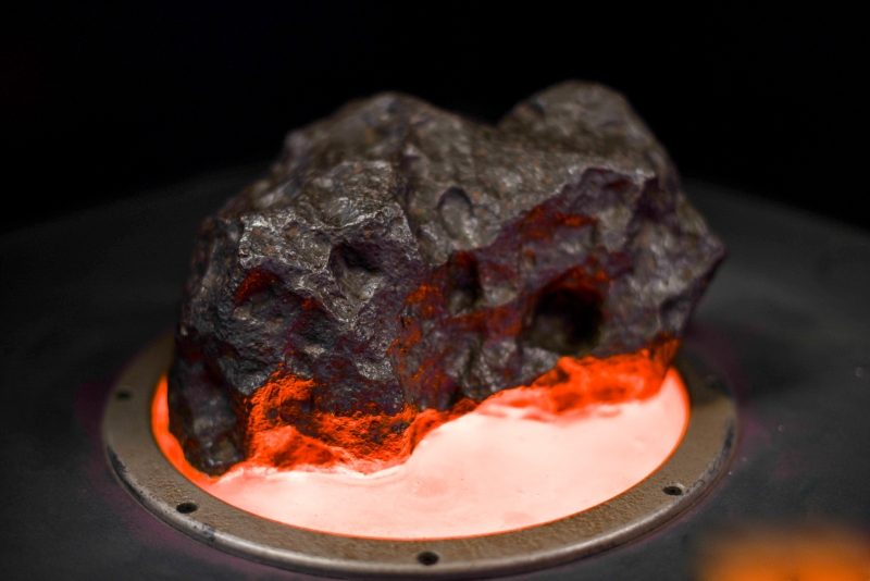
An actual meteorite in our Space Sciences exhibits.
People often show us rocks which they hope came from outer space. When it comes to meteorites and “meteowrongs,” we highly recommend the resources shared by lunar geochemist Randy Korotev, Ph.D., of the Department of Earth and Planetary Sciences at Washington University in St. Louis. Dr. Korotev shares a handy flowchart created by a group of Brazilian scientists. If you’re thinking of asking us about a potential meteorite, be sure to check that flowchart first. Sometimes would-be meteorites found in our area are the result of local mining and refining. There’s been plenty of ore processing in our area (like the cinnabar processing at Red Rock) and we’ve seen numerous pieces of slag—metal refining waste—brought in to the Museum. It’s interesting to learn more about that local history. And if you’re not satisfied by something from our home planet, well, there are some impressive meteorites you can check out in our Space Sciences exhibits.
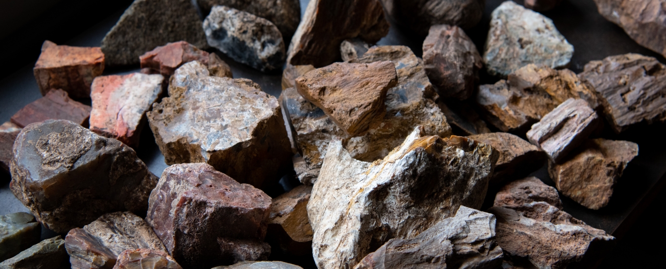
The colors and textures of rocks can reveal their mineral composition. Some rocks show lovely red, pink, and peach-colored surfaces. Often, this is the result of the presence of a small amount of iron. Once exposed to the water or air, that iron oxidizes (a fancy term for rusting). If that oxidized outer layer that we call weathering rind falls off (or spalls off), the somewhat fresher rock below is exposed, and you can see contrasting colors at the surface, which are interesting to look at.
We also love the green color of serpentinite, which is abundant in the local Franciscan Complex. Serpentinite is the official California state rock and gets its green color from the serpentine group of minerals.
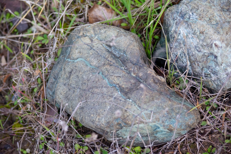
Some serpentine-bearing rocks in their natural habitat near Mt. Figueroa
The Franciscan Complex started out as sedimentary rocks formed from marine sediments deposited on the sea floor millions of years ago, during the Mesozoic, when dinosaurs roamed the earth and weird reptiles swam in the seas. Those sediments were later squeezed by two tectonic plates as one slid under the other in a process called subduction. The extreme pressure and heat generated by this subduction process changed the mineral content and texture of these rocks. In fancy science words, they were metamorphosed. When this happened, these rocks were deep underground, so how did they make it up to the surface, where we find them? In a word, uplift. About 18 million years ago, the land that would become Santa Barbara was actually down near the San Diego area. This bit of land broke off of the North American Plate and started pivoting and slowly hitchhiking north along with the neighboring Pacific Plate. While this piece rode along the plate margin, it rotated counterclockwise into the position it now holds today, where it runs east-to-west, unlike the rest of the coastline.
About six million years ago, as this piece of land collided back into the rest of North America, that slow but powerful impact of land masses pushed up all the mountain ranges that run east-to-west (known as the Transverse Ranges). These include the Santa Ynez Mountains right here behind us in Santa Barbara. The forces that pushed up those mountains pushed up their constituent rocks, including Franciscan rocks. This is all to say that the colorful and interesting rocks of the Franciscan Assemblage have taken a long journey to arrive where we can appreciate them. For help visualizing this process, check out this video about local tectonic history produced by the National Park Service.
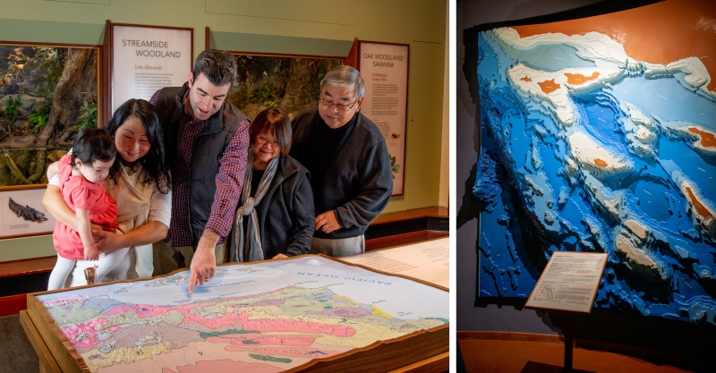
Our part of California’s coast runs east to west because of its unique tectonic history. At the Museum, you can find three-dimensional representations of its topography in Santa Barbara Gallery and its bathymetry (underwater topography) in Marine Science.
Chert is also abundant in the Franciscan Complex and Monterey Formation. Chert is a cryptocrystalline (having a crystal structure so small it can only be seen when magnified) form of silica. Chert tends to have a milky color, but also takes on different colors with the addition of various components. Monterey chert forms in layers in Monterey shale, and gets its characteristic dark brown and black color from being rich in the same materials that produce all the tar, oil, and asphaltum in the Monterey Formation. Franciscan chert is more likely to include red hues.
Franciscan Complex chert was commonly used by the Chumash people as raw material to fashion projectile points and other stone tools. This use for chert is reflected in the fact that some people use the word "chert" interchangeably with the word "flint," while others note a distinction in how the two kinds of rocks are formed.
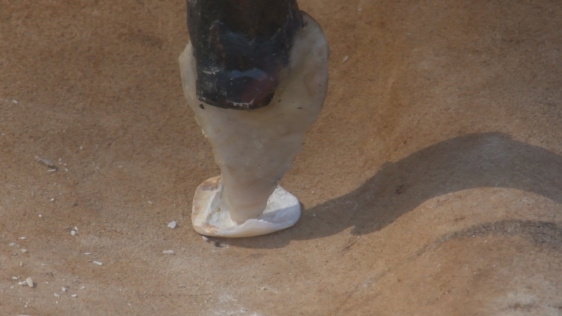
Chumash moneymakers drilled holes for stringing bead money with chert flake drills like this reproduction.
Weathering affects the appearance of rocks.
Weathering is what happens when rocks are exposed to ... weather! Rain, snow, sun exposure, and wind all wear down the surface of rocks, causing the formation of cracks, the wearing down of edges, the development of a layer that looks like a rind, and other fun features. If there is any water around, it may flow through cracks and deposit minerals, creating groovy stripes of color.
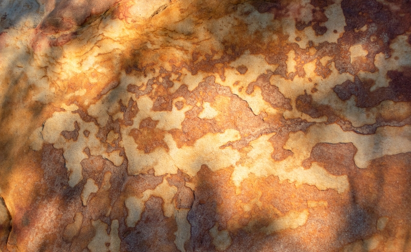
The iron content in this sandstone on Gaviota Peak has oxidized, creating a rind of fun reddish shapes.
The appearance of rings or a bark-like layer of “rind” as a result of weathering and other chemical transformations can make a rock look like petrified wood. Petrified wood is rare here, for basically the same reason we have very few terrestrial dinosaurs: this portion of California has been underwater a lot of the time. In some places though, we can find mostly small pieces of wood or charcoal that have been swept in the ocean by prehistoric rivers. Check out the bituminous (tarry) residue of petrified wood on a piece of Coldwater sandstone in our Earth Science exhibits.
Be mindful of where, how, and what you collect.
You might be surprised to learn what is regulated and why.
The precise rules for collecting vary a little among different public lands, depending on the agency that manages the land (e.g., state beaches vs. national parks). Vertebrate fossils are protected on all public lands (i.e., federal, state, county, and local) and require a permit for collecting. Rock and fossil collecting is prohibited in almost all our national parks. Also, anything human-related is protected: don’t disturb any archaeological artifacts, and call law enforcement if you find human remains (even archaeologists have to verify with the police that their subjects aren’t related to an open case). California state law also protects plant and invertebrate fossils on state, county, and local lands (e.g., local and county beaches), although you can request permission to collect from the agency that manages the lands.
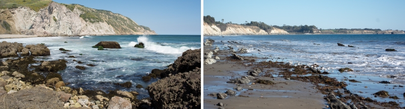
Same region, different beach, different rules. If you collect, educate yourself first. To be safe, stick to taking only photos.
While fossil collecting of any kind is illegal on lands managed by the National Park Service and U.S. Fish and Wildlife Service, “casual collecting” of commonly found invertebrate and plant fossils is permissible on some federal lands managed by the Bureau of Land Management, Bureau of Reclamation, and U.S. Forestry Service. Casual collecting refers to a reasonable amount of fossils that are collected for non-commercial use (i.e., you aren’t collecting to sell) in a way that does not significantly disturb the Earth’s surface (i.e., don’t use power tools or exceed 1 square yard of digging). Check with the institution that administers the land before you collect.
One of the reasons for these legal protections is the fact that specimens lose scientific value when removed from their context. When paleontologists are out in the field collecting fossils, we record a lot of information about what’s around the specimens. This goes beyond GPS coordinates and into the geological details of the surrounding rocks and soil, plus all the information about the position of the fossil which might suggest how the animal died and became fossilized (this is called taphonomy). When you remove a fossil, it’s like taking a body out of a crime scene. This is particularly important for vertebrate fossils since they are rarer than invertebrate and plant fossils.
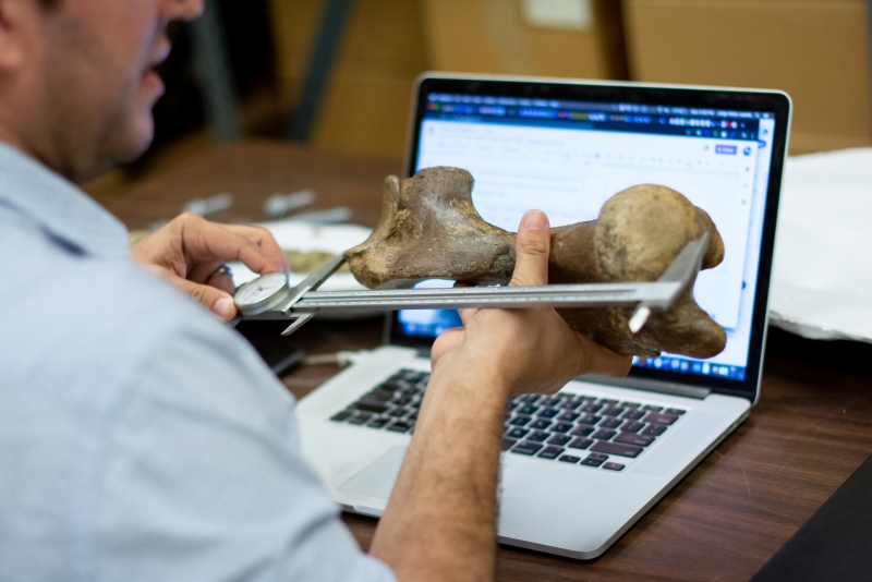
Visiting researchers learn more from our collections because specimens are associated with data about the geologic context they came from.
Another great reason for leaving fossils where you find them is to preserve those cool things for future visitors to enjoy. When scientists collect specimens, they go into collections that are accessible to other researchers, or into museums where the public can learn from them. Too often, privately collected fossils end up forgotten in a shoebox in someone’s closet. Additionally, some commercial collectors have exploited the previously lax laws for profit.
The best thing you can do when you find something neat is to take a photo rather than taking the specimen out of its context. Include something like a coin or ruler for size reference. You can share that photo to learn more from experts (for instance, through our Ask a Curator page). If the specimen looks scientifically important, the SBMNH can apply for a collecting permit so that fossil will be collected—with all of the useful contextual information—and made available to researchers and the public. If it’s not scientifically significant, you’ll still have a memento of the cool thing you encountered, and other people who visit the place can enjoy the same feeling of discovery.
While we hope your awareness of those laws informs your collecting habits, don’t let them scare you away from the Museum if you didn’t know the rules. We welcome opportunities to learn from specimens and help people understand ways to appreciate fossils legally.
Further Learning
In addition to the exhibits and resources linked above, we recommend:
Further reading:
Channel Islands National Park: Geologic Formations
Geology Underfoot in Southern California
Cruisin’ the Fossil Coastline
Curriculum:
Teacher-Friendly Guide™ to the Earth Science of the Western US
National Association of Geoscience Teachers: Teaching Resources
National Earth Science Teachers Association: Teaching Resources
Higher education:
SBCC Earth & Planetary Sciences
UCSB Earth Science
Still puzzling over an earth science mystery? Write us on the Ask a Curator page: sbnature.org/ask
Acknowledgments
It takes a team to answer your questions!
This resource is based on information shared by our geologists, paleontologists, and anthropologists in response to the many questions we receive from the public. Particular credit goes to the following staff members:
- Dibblee Curator of Earth Science Jonathan Hoffman, Ph.D., who works in our Department of Vertebrate Zoology
- Nature Education Manager Sabina Thomas, Ph.D., who has taught geology here at the Museum as well as at SBCC and UCSB
- Director of Education Jenna Rolle, M.S., who has taught paleontology and geology at UCSB and SBCC and whose background is in paleobiology
…plus a special shoutout to Associate Curator of Anthropology Brian Barbier, M.A., who assisted at the intersection of geology and culture.